Conference
-2010 Sep., Macau
| Name/Title | Field Training for Sediment-related Disaster Hazard Mapping Project and Integrated Workshop of Typhoon Committee |
|---|---|
| Venue: Country,City | Macau |
| Date | Sep., 2010 |
| Detail |
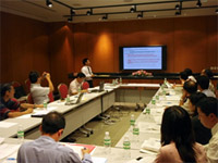
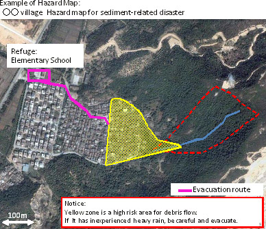
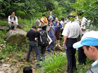
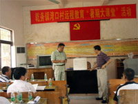
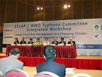
1. Field Training for Sediment-related Disaster Hazard Mapping ProjectOn Sept. 4, 2010 at the Macau Science Center, we provided a seminar on the hazard area setting method based on Japan's sediment-related disaster hazard area (Yellow Zone for debris flows & slope failures) setting method backed by the Sediment-related Disaster Prevention Law, preparation method of a hazard map after hazard area setting, as well as the outline of field training to be conducted on the next day (Photo 1). During the seminar, defining the hazard map as a map for safe evacuation of residents, we emphasized that the map should include not only hazard area information but also evacuation route & shelter information and hazard level description, and that the completed map should be actively utilized for the evacuation of residents. We also explained the roles of local officials and residents and other important points relating to the usage of a hazard map, including the designation of a responsible person to decide an evacuation and the ways to assist vulnerable persons during an evacuation, by introducing Japan's nationwide disaster drill against sediment-related disasters being held in June every year as an example. The participating members of this Project are required to set a hazard area at the model site they choose and prepare a hazard map within the year 2010 as a project accomplishment by referring to the preparation example of a hazard map presented by Japan (Figure 1). Active discussion was made at the subsequent Q&A time. One question asked was why a variety of contributing factors to sediment-related disasters, such as geology, were not taken into account in the Japanese hazard area setting method. Our reply was that we adopted a simplified setting method underpinned by technological knowledge such as the actual flooding area during past sediment-related disasters and the fluidizing mechanism of debris flows, because our priority is to ensure residents' safety and promote hazard area designation. On the next day, Sept. 5, field training was conducted at the model stream in China's Zhuhai City, which is located next to Macau. The participants of the field training were divided into two groups: a) members of the Typhoon Committee; b) engineering officials of Zhuhai City who participated in the training for the spread of technology and the enlightenment of local people, and residents of the village where the model stream is located. The participants of the former group deepened understanding by applying what they had learned at the previous day's seminar to an actual mountain stream through various tasks, including confirmation of the positional relationship between the stream and the object to be protected, possible flow direction of a debris flow, the upstream and downstream ends of the hazard area (stream gradient 10 and 2 , respectively), and confirmation of evacuation routes and shelters (Photo 2). For the engineering officials and village residents, we explained the timing of evacuation, the roles of local officials and residents, and other important matters, in addition to the training given to the former group (Photo 3). The participants of the seminar and field training consisted of 20 persons from 9 countries and areas (Cambodia, China, North Korea, Hong Kong, South Korea, Macau, Thailand, Philippines, and Japan) of the Typhoon Committee and 15 persons who are engineering officials of Zhuhai City and local residents. Participants' comments on the seminar and training include: (1) the hazard area setting method presented by Japan is simple, easy to understand, and practical for their countries; and (2) their understanding of the setting method was improved thanks to the combined seminar and training at an actual stream. 2. Integrated Workshop of the Typhoon CommitteeThe Integrated Workshop began on Sept. 6 (Photo 4). At the meeting of the working group on hydrology held on Sept. 7, we reported the outline of the seminar and field training conducted on Sept. 4 and 5 and the progress status of the Project. In order to advance the Project steadily, it was determined that the project-participating members should complete the selection of a model site, setting of a hazard area, and preparation of a hazard map by the time of the 43rd plenary meeting of the Typhoon Committee slated for January 2011 by making use of the knowledge gained from the seminar and field training.
|
